Colorado Trail missed section near Monarch Pass

August 06, 2026

We got up at 6:00 and had breakfast with my dad and stepmom. We got on the road a bit before 8:00.

There wasn’t too much traffic and we made good time to Poncha Springs. We headed up the road towards Monarch Pass and stopped to pick up our resupply box from the Butterfly House. It was there. The address label clearly shows the proper ZIP code and address, but one end of the box had been crushed on its long journey to Kansas, Alaska, and back to Colorado.

We continued on to the top of Monarch Pass and stopped at the gift shop to use the bathroom. We also split a big scoop of ice cream.

We got on the trail towards Boss Lake trailhead around 11:15. We skipped the segment of trail between Boss Lake and Monarch Pass - we had walked out the jeep road to the Butterfly House hostel. When our resupply box was in Kansas instead of being at the Butterfly House, and the hostel had no food cart this year, we had hitched into Salida so we could resupply. Then it was much easier to hitch to Monarch Pass than to get up to Boss Lake on the jeep road.

The trail climbs away from the highway and then follows the ridge through the Monarch Ski Resort.

“Zebra” hill across from Monarch Ski Area
“Zebra” hill across from Monarch Ski Area - Collegiate West trail

We weren’t sure if the tree thinning is for fire mitigation or trying to collect more snow.

Monarch Ski Area
Monarch Ski Area - Collegiate West trail

Once past the ski area the trail continues climbing along the ridge towards Bald Mountain. We stopped for lunch behind a few trees because there was a strong wind from the southwest. The trail skirts behind the top of Bald Mountain to a saddle above a lake.

Traversing side of Bald Mountain
Traversing side of Bald Mountain - Collegiate West trail
Lake north of Bald Mountain
Lake north of Bald Mountain - Collegiate West trail
Cairn on Collegiate West trail

The wind got really strong near the saddle so we were glad to descend into the valley. After going by the small lakes the trail follows a tiny creek steeply down past Hunt Lake towards Boss Lake Reservoir.

Collegiate West trail
Hunt Lake
Hunt Lake - Collegiate West trail

We got down to a jeep road and followed that a more than a mile out to the highway. We put our thumbs out and it didn’t take too long before we got a ride back up to the top of the pass from some young guys visiting from Texas.

We got back to the car and drove down to The Lodge at Poncha Springs. We checked in to our room and washed up a little, but we were hungry so we quickly headed over to Elevation Beer Company. We got some dinner from the “Patty Wagon” food cart there and tried some more of their beers. The beer really is good there, and we bought several varieties to take with us to New Mexico where we will be staying for a week.

Elevation Beer Company
Elevation Beer Company - Poncha Springs, CO

Colorado Trail day 38

August 01, 2026

Colorado Day - Colorado turned 150 years old!

Julie woke up early but read her book in bed while I slept until almost 6:30. A couple people hiked past the tent before we got up. It was windy off and on overnight but our tent was well sheltered. Someone woke up very early with the moon shining through the trees and casting shadows from the aspen on the tent.

Moonlight view from inside the tent
Moonlight view from inside the tent - Colorado Trail segment 28

We made hot drinks and ate some protein bars, then got on trail a bit before 8:30. The trail stays high above Junction Creek for miles, winding in and out of tributary canyons. At one ridge we could look back and barely make out where the trail crossed the big talus slope the day before.

Looking back at the talus slope we crossed the day before
Looking back at the talus slope we crossed the day before - Colorado Trail segment 28

Eventually the trail crosses a ridge and follows a different canyon on an old road bed, gradually working its way around some ridges back to the Junction Creek canyon. With it being Saturday there were a lot of mountain bikers on the trail and a few side trails.

Colorado Trail segment 28
Trail sign on Colorado Trail segment 28

We found where we had five miles of trail remaining and took another “1%” photo.

Five miles (one percent) of Colorado Trail remaining
Five miles (one percent) of Colorado Trail remaining - Colorado Trail segment 28

There is a bench above a cliff called Gudy’s Rest in honor of Gudy Gaskill, the woman who instigated the Colorado Trail. We stopped there for a bit and talked to a woman with a couple of cute dogs.

Gudy’s Rest (named for Gudy Gaskill) overlooking Junction Creek
Gudy’s Rest (named for Gudy Gaskill) overlooking Junction Creek - Colorado Trail segment 28

The trail switchbacks down to Junction Creek and crosses it on a bridge. Then it follows the creek on the east side down to a couple of trailheads, one near the large Junction Creek campground, and finally the one where the Colorado Trail ends.

End of the Colorado Trail
End of the Colorado Trail - End of Colorado Trail segment 28

11.5 miles of trail over a bit under six hours. We made it!

We talked with an older couple in the parking lot who were waiting for their son to finish the trail. They said they would give us a ride, but they were going up to the Junction Creek campground so it would be the wrong direction. We walked down the road towards Durango with our thumbs out. There wasn’t much traffic but before we made it a mile a man and his daughter and two dogs picked us up. They were really nice and took us straight to our hotel even though it was out of their way.

We checked in to the Fairfield Inn & Suites a bit before the 3:00 check in time with a very friendly desk person. They have a laundry room so we were able to get most of our clothes clean while we showered.

Afterwards we walked across the Animas River to the downtown area and went to Steamworks Brewing Company. It was busy but we got a tasting flight while we waited for a table. The beers are better than many, the food was tasty, and we came back with a 4-pack of their Lizard Head amber ale.

Steamworks Brewing Company
Steamworks Brewing Company - Durango, CO
Steamworks Brewing Company
Steamworks Brewing Company - Durango, CO

We still have 11 miles to make up between Boss Lake and Monarch Pass, then we will have to come back next year to do the segments we missed due to the fire near Leadville, but it’s still quite a feeling of accomplishment. At the same time it is difficult to face “normal life“ again after living as full time hikers for over a month. I will try to write some summary thoughts soon.


Colorado Trail day 37

July 31, 2026

We woke up a bit after 6:00 and the sun rose around 6:15. We made hot drinks and tried Farm to Summit’s oat milk and granola for breakfast. We got on trail a bit before 8:30. A buck deer came near the camp, I think it was trying to eat the plants I had urinated on the night before. I saw similar behavior with a doe a couple days before - I guess some of the salt in the electrolyte mixes I drink must not be fully utilized.

Morning visit from a buck on Indian Trail Ridge
Morning visit from a buck on Indian Trail Ridge - Colorado Trail segment 27

Later that buck joined three others for a morning visit to the top of the nearby hill. I didn’t think the bucks spent time together, but this was like a morning meeting.

Morning gathering of bucks on Indian Trail Ridge
Morning gathering of bucks on Indian Trail Ridge - Colorado Trail segment 27

The granola was tasty but didn’t keep us full for long - after less than two miles we were looking for snacks. Granted, it was a tough couple of miles: we had to climb up and down a couple of very steep hills on the ridge we were following, Indian Trail Ridge.

Indian Trail Ridge
Indian Trail Ridge - Colorado Trail segment 27
View down Bear Creek valley from Colorado Trail segment 27

Finally we climbed down near Taylor Lake. We stopped at a cute, tiny waterfall to filter some water. A short walk from the tiny creek coming out of the lake brought us to a trailhead parking area. We walked a bit further and stopped for another snack.

Taylor Lake
Taylor Lake - Colorado Trail segment 27

The trail climbed up to Kennebec Pass where there was a side trail that continued to an old mine with what looked like a somewhat modern house. I think it is the Muldoon mine.

Muldoon Mine
Muldoon Mine - Colorado Trail segment 28

The trail descended steeply across a huge talus slope. Snowmelt had eroded some parts - it was one of the scariest parts of the whole Colorado Trail. It’s also a south-facing slope with the sun shining, and the day was hotter than we have been used to for the past couple of weeks. We got down to some trees and stopped for lunch.

View back towards Kennebec Pass
View back towards Kennebec Pass - Colorado Trail segment 28

The trail continued dropping, generally not as steeply, down to Junction Creek. It follows the creek for a couple miles through a steep canyon with cliffs.

Waterfall tributary of Junction Creek
Waterfall tributary of Junction Creek - Colorado Trail segment 28

We stopped to filter some more water and wash some undergarments. With the heat we were going through our water faster than we grown used to. Eventually the trail crosses the creek on a bridge and then climbs up side of the canyon. Some of the climb was steep, and the footing and the slopes were tougher than the previous day - we started getting tired.

We had leapfrogged a cheerful young man a few times during the day. He told us August 1st is Colorado Day, and Colorado will be 150 years old when we finish the trail.

We found a nice campsite but realized we didn’t have enough water, so we ended up hiking another almost two miles to cross a creek and get more water, then found a little site near an aspen grove in a little saddle around 6:15.

Camp above Junction Creek
Camp above Junction Creek - Colorado Trail segment 28

15 miles over ten hours.


Colorado Trail day 36

July 30, 2026

There were some gusty winds overnight but otherwise fine weather. It felt nice to wake up to a completely dry tent. We got on trail a bit before 8:30.

Several people had passed by while we were setting up, eating dinner, and even some hiking with headlamps after we went to bed. However we passed only two tents in the morning - we (mostly me) are just slow in the morning compared to most through-hikers.

The trail follows down the Straight Creek Valley, crossing to the east side of the creek, then staying level along that side of the valley as the creek continues to fall. It crosses a small tributary stream and that is the last water source for almost 14 miles. Eventually, the trail leaves the valley and follows around the south side of a mountain. From there it follows along the top of a ridge, for several miles on an old road bed. A trail angel had left several gallons of water at a trailhead in this area but they were all empty.

View up Straight Creek valley
View up Straight Creek valley - Colorado Trail segment 27

The trail leaves the old road and begins skirting the eastern border of the Hermosa Creek Wilderness Area. The geology is interesting because the Hermosa Creek area seems to have eroded out of a different system of hills and valleys. For miles we walked with a steep drop to the left (west) and gently rolling country to the right. There is a forest road that also runs along the border of the Wilderness and some other trail angels left a couple other water caches where the trail meets the road. We took about half a gallon from one of these, although we ended up finally reaching Deer Creek still having about that amount - definitely better to have a little extra water than to run out - thank you anonymous trail angel! Although Deer Creek did not have a strong flow, it was flowing and we loaded up with a total of 5.5 liters.

Colorado Trail segment 27
Hermosa Creek Wilderness on the left of the trail
Hermosa Creek Wilderness on the left of the trail - Colorado Trail segment 27

We walked almost four more miles and found a really neat campsite tucked into some trees in a saddle, still having the big drop to the west.

Camp on Indian Trail Ridge
Camp on Indian Trail Ridge - Colorado Trail segment 27
Evening light on clouds from Indian Trail Ridge
Evening light on clouds from Indian Trail Ridge - Colorado Trail segment 27

The view to the northwest is fascinating to us because we can see distant mountains that we were on the other side of not that many days ago. Closer we can see Hermosa Peak and the ridge behind it - Cascade Creek and our thunderstorm night was behind that ridge. Further we can see the Needle Mountains - our descent down Elk Creek to the train was on the other side of those.

View towards Needle Mountains from Colorado Trail segment 27

18.5 miles over almost 10 hours.


Colorado Trail day 35

July 29, 2026

It rained and sometimes poured from 10:15 to 11:15 with a light show and sound effects. Because we had chosen an established campsite there was bare dirt all around the tent. With how hard it rained that dirt quickly became mud puddles that started splashing mud onto and a little bit into the tent. I moved some things around to try to mitigate it. It was very unpleasant but the tent did its job - despite puddles all around, water never came up from the floor and I don’t think the roof leaked, but the splashing made it hard to tell.

When we got up a bit before 6:00 almost everything we had that was not in a watertight bag was wet or damp, and a lot of it was muddy or at least dirty. We rinsed a few things off in the creek. Our neighbors left around 7:00 and we got on trail a little bit before 8:00.

The Cascade Creek valley was very pretty both the evening before and in the morning, but the lighting and angles never made for great photos.

Cascade Creek
Cascade Creek - Colorado Trail segment 25

We crossed the creek and climbed up out of that valley and followed a ridge across a few more creeks. Eventually we climbed up to a saddle and entered the valley where Bolam Pass and Hermosa Park are, and our first glimpse of Lizardhead Peak.

Creek with white deposits on Colorado Trail segment 25
Colorado Trail segment 25
Near headwaters of Dolores River - first view of Lizardhead Peak
Near headwaters of Dolores River - first view of Lizardhead Peak - Colorado Trail segment 25

We had driven up a jeep road a couple years ago and hiked a few miles of the Colorado Trail below Hermosa Peak. We hiked across the wide valley and up to the base of Hermosa Peak and had lunch in the same spot where we had talked to a Colorado Trail hiker on that trip. The previous day we had hiked up to the base of Lizardhead Peak and the views from there were very memorable.

Hermosa Peak
Hermosa Peak - Colorado Trail segment 26
View towards Grizzly Peak
View towards Grizzly Peak - Colorado Trail segment 26
View north from Colorado Trail segment 26

We continued around Hermosa Peak and then around a couple of red rock peaks. We stopped at the top of the valley formed by Silver Creek and filtered water. There was a fairly nice campsite there and the clouds were looking threatening off and on. Eventually we decided to go ahead and climb over Blackhawk Pass to the Straight Creek valley.

Colorado Trail segment 26
Blackhawk Mountain / Blackhawk Pass
Blackhawk Mountain / Blackhawk Pass - Colorado Trail segment 26
View north from Blackhawk Pass
View north from Blackhawk Pass - Colorado Trail segment 26

We found a number of the campsites taken. The trail crosses Straight Creek twice and a tributary as it climbs out of the canyon, but that is the last listed water source for over twelve miles, so this canyon is a very popular camp area.

Trail down from Blackhawk Pass
Trail down from Blackhawk Pass - Colorado Trail segment 26
Marmot on Blackhawk Pass
Marmot on Blackhawk Pass - Colorado Trail segment 26

We eventually chose a somewhat sloped site that looked like it might have been used before. We set the tent up and left it empty so the wet interior could dry for well over an hour. It turned out there was a tiny brook nearby so I was able to do some laundry while Julie made dinner. This time we tried Butternut Dahl curry from Peak and it was pretty good.

Camp above Straight Creek
Camp above Straight Creek - Colorado Trail segment 26

We filtered more water to get a head start on tomorrow’s load and then set up our sleeping bags.

14.2 miles over nine and a half hours.


Colorado Trail day 34

July 28, 2026

We left the Avon Hotel at 7:00. We walked to the Whistlestop gas station at the south end of town. We got some sausage and egg bagel sandwiches for breakfast and ate them.

Then we went out to the highway to hitch a ride up to Molas Pass. Unfortunately very few vehicles were going south of town. Lots of people went to the gas station and then went north or back into the town. Eventually a truck with three Hispanic guys stopped and picked us up. It was a little bit different than our previous hitches because there was very little conversation, and what little there was took place mostly in Spanish. We arrived at the Molas Pass scenic overlook a little bit before 8:00.

Note that this hitch has us missing about 6 miles of trail from the train tracks up to Molas Pass. We had been told that there was a way to take the train back to the flag stop and continue the hike without any gaps. However, it turns out that we would have had to buy round-trip tickets from Silverton to Durango and back, then I think ride all the way from Silverton to Durango and then get dropped off on the way back to Silverton. Those round trip tickets are very expensive and it would take all day to ride the train back and forth, so we are missing six more miles of Colorado Trail.

Colorado Trail crossing highway 550 at Molas Pass
Colorado Trail crossing highway 550 at Molas Pass - Start of Colorado Trail segment 25
Little Molas Lake
Little Molas Lake - Colorado Trail segment 25

We walked for a couple hours and then stopped and ate the leftover pizza from the night before at a fairly scenic spot.

Colorado Trail segment 25

We walked another hour and stopped around noon to eat the sandwich that we had gotten “to go” from the restaurant. As we ate, the skies darkened further and it started raining. We decided to sit out the rain since we already had a pad set up to sit on. We were also not going because we could hear thunder. It mostly seemed to be just cloud to cloud lightning since we did not see any strikes, but we were nearing a saddle and did not want to be exposed during the thunderstorm. The rain was heavy off and on for about half an hour.

Eventually, the rain stopped and the skies got a little brighter so we decided to get going again. We hiked up for another 20 minutes or so and it started hailing. We found a little place to put our sitting pad and sat out the brief hail storm.

Climbing towards a saddle with threatening clouds
Climbing towards a saddle with threatening clouds - Colorado Trail segment 25
Image from Flickr

Finally, the hail subsided to a light rain and we made it up to the saddle only to find that the trail followed around the shoulder of a mountain to a different saddle a couple hundred feet higher up and across the small valley. The clouds continued to look threatening, but it was only light rain off and on.

As soon as we crossed this higher saddle we looked out on a sunny valley, and the weather looked much better on that side. We walked a couple hundred feet down from the pass and took all our rain gear off. We continued hiking down and within 10 minutes we had to put our rain gear back on because, despite the sun shining, it began raining again. It rained for a surprisingly long time all while the sun shone on us.

A new vista
A new vista - Colorado Trail segment 25

We finished listening to the audiobook Listen for the Lie. It was enjoyable - the writing is good and the personalities of the characters are interesting, but the mystery hinges on a sort of hard to believe event.

Eventually, the rain stopped and we stopped for a snack and to let some of the rain gear dry out.

Rest break at intersection with White Creek Trail
Rest break at intersection with White Creek Trail - Colorado Trail segment 25

The valley was pretty and we descended quite a way before following around a mountainside to Cascade Creek. There are a number of good campsites near a bridge that crosses the creek, but the best sites were already taken when we arrived at 4:00. We found a less-sheltered site and set up the tent just before another rain shower.

Tributary of Cascade Creek
Tributary of Cascade Creek - Colorado Trail segment 25
One of many waterfalls on aptly-named Cascade Creek
One of many waterfalls on aptly-named Cascade Creek - Colorado Trail segment 25
Gudy Gaskill monument near Cascade Creek
Gudy Gaskill monument near Cascade Creek - Colorado Trail segment 25

After pumping up our air mattresses we laid down and read for a while. The rain ended and we kept relaxing until we realized we should probably make dinner. We got out of the tent and found “Lifer” talking to our new neighbors. He was camped just a little further upstream. We talked to him while Julie made some Italian split pea soup she’d found at the Silverton grocery. It tasted good but maybe a bit too salty. We split a giant rice crispy treat for dessert.

Campsite on Cascade Creek
Campsite on Cascade Creek - Colorado Trail segment 25

We’d used the last of our water to make the soup so we had to go filter more from the creek. We talked to Lifer a bit more since he was close to where we got the water. Then we went to bed - neither of us had slept very well the second night in Silverton.

14 miles in eight hours.


Colorado Trail day 33

July 27, 2026

We slept in until 6:30. We managed to get some hot drinks from the bar/kitchen downstairs, but I had to use my camping mug and a tea bag because Julie found the last mug in the kitchen. For the price we are paying at the Avon Hotel the amenities seem lacking.

It was really foggy in the morning. We walked several blocks up to the Kendall Mountain Cafe and had really nice breakfasts. Julie got the huevos rancheros and ended up with lots left over and I got a “Monte Cristo” breakfast sandwich of French toast with eggs, ham, and cheese. Their French toast is really good!

Foggy morning in Silverton, CO
Breakfast at Kendall Mountain Cafe
Breakfast at Kendall Mountain Cafe - Silverton, CO

We stopped in a shop on the way back to the room and each bought a fourth pair of Darn Tough merino wool socks. We really like these socks but they take so long to dry when we wash them on trail, and it looks like we are going to see more rain, that we decided it is worth carrying a few ounces more to have dry socks.

Avon Hotel lobby/bar in Silverton, CO

Back at the hotel I worked on the blog a bit and Julie organized our food and finalized our shopping list. She went out and found that the bike shop had some trekking poles so I joined her and picked out some - another $100. We also found some good protein bars and drink mixes at the hardware store.

Organizing meals again

Back at the room I tried to drown my inflatable mattress in the bathtub because it has a slow leak. Unfortunately I couldn’t find anything definitive, although it might be leaking from the valve.

We ate our leftover pizza and Julie’s breakfast for lunch. “Lifer” and his brother, who hiked up to meet him on the trail, showed up and talked with us for quite a while. Interesting guys but boy do they talk a lot!

I worked on the blog and Julie researched water and camping options on the last few segments. There was a huge thunderstorm around 4:30 that went on until almost 5:30. Torrential rain with occasional blasts of hail and some major wind gusts. We were very grateful not to be out on the trail, but we thought about some of the hikers like Bright Side who had headed back up to the trail after riding the train into town and doing a quick resupply - hopefully it was not as bad up on the mountains above town.

Thunderstorm in Silverton, CO

We walked back to the Golden Block Brewery again. We got a very tasty “Chinese Laundry” pizza for dinner and a sandwich “to go” for lunch on the trail tomorrow.

Second visit to Golden Block Brewery
Second visit to Golden Block Brewery - Silverton, CO

Colorado Trail day 32

July 26, 2026

We got up a little after 6:00. It was cloudy, the first cloudy morning in a long time. Our socks and underwear were still damp even though we had left one of the tent vestibule doors open overnight.

We made hot drinks and instant oatmeal for breakfast.

We delayed putting on the damp socks and wet shoes for as long as possible - it was unpleasant.

We got on trail a little bit before 9:00. We dropped a bunch of elevation in the first mile but then the trail alternated between being down by the creek and going up the side of the valley to avoid cliffs. At one point the trail was just large rocks in the creek.

Hop on rocks to continue down Elk Creek canyon
Hop on rocks to continue down Elk Creek canyon - Colorado Trail segment 24

Erosion is definitely still happening in this canyon, and we passed a couple places where avalanches had piled a bunch of trees in the bottom of the canyon. The slopes of the valley sides are impressively steep.

Avalanche log jam in Elk Creek canyon
Avalanche log jam in Elk Creek canyon - Colorado Trail segment 24
Elk Creek canyon
Elk Creek canyon - Colorado Trail segment 24
Turn off to the train stop in Elk Creek
Turn off to the train stop in Elk Creek - Colorado Trail segment 24

We arrived at the Durango & Silverton train stop on the Animas River at about 10:00 after a bit over two miles of hiking. The train is scheduled to arrive at 11:04, so we had plenty of time to eat some snacks and chat with other hikers and climbers - climbing Vestal and Arrow peaks is popular, and the train offers a shorter way to get close to the base of the mountains.

People waiting for the Durango & Silverton train
People waiting for the Durango & Silverton train - Colorado Trail segment 24
Elk Park flag stop for Durango & Silverton train
Durango & Silverton train at Elk Park flag stop

The train arrived on time and we paid $35 each for the half hour ride into Silverton. The tracks follow the Animas River through some narrow and scenic parts of the canyon. The track is pretty bumpy and walking around while the train is moving is challenging. We got some sodas and were happy to sit down with them.

Enjoying sodas on the Durango & Silverton train

In Silverton the train just parks on 12th Street - there is no train station or anything formal. We retrieved our packs from the baggage car and walked over to the Avon Hotel where we had reserved a room.

Durango & Silverton train on 12th street in Silverton, CO

It was a bit before noon and check in wasn’t until 3:00. No-one was working at the hotel except a cleaner. We texted the owner as instructed to ask about leaving our packs but never received a reply. We, along with several other hikers who had arrived on the train, just left our packs in the second floor common area.

We walked to El Bandito Mexican restaurant and had lunch. The waitress had recently arrived from Peru and we practiced our Spanish with her. The food and drinks were good.

Burrito and tacos at El Bandito in Silverton, CO

Then we went to the grocery store to see what kinds of meals we could get. We found some of what we were looking for, but couldn’t find many things we wanted. Very limited choices. We picked up a few things we knew we needed and it was $100 - resupply days are surprisingly expensive.

We walked around town looking for places to buy new trekking poles and other supplies. Unfortunately the stores that might have trekking poles were closed because it was Sunday. We ended up going to the Golden Block Brewery. We got a tasting flight plus a glass of their barrel aged beer and a cheese pizza. The beers were very good and they manage to impart clear, interesting flavors to their beers - recommended. We brought half of the pizza back with us.

Golden Block Brewery in Silverton, CO

Finally it was 3:00 and we returned to the hotel and checked in by phone call. We showered and then put our dirty clothes (everything except what we were wearing) in a bag and I went to the laundromat. Julie returned to the grocery store and got a bottle of wine and some hummus and carrots.

We ate the hummus and carrots in the room for a while before deciding that we really were still hungry. We walked to The Eureka Station and split a salad and some very tasty sweet potato fritters, then split a peach cobbler for dessert.


Colorado Trail day 31

July 25, 2026

It was chilly but not as cold as the night before. We still woke up with the inside and outside of the tent wet. However, we stayed in bed until almost 6:30 and the sun began hitting the tent - lucky positioning! We got up and pulled our sleeping bags out and put them on a large rock that was dry (and freshly cleaned from the rain last night!) so that they could dry in the sun since they were a bit damp as well.

With the shortage of water, we decided to hike a little way and get more water before making hot drinks. There was a creek in a bit less than a mile and then we stopped after another 3/4 mile or so when we found a flat rock with a bit of a view.

View to the Needle Mountains
View to the Needle Mountains - Colorado Trail segment 24

Shortly afterwards the trail crested a ridge and the views started being epic.

For about three miles the trail goes up and down small ridges that are all on this high, large ridge. There are no trees and bushes only near ponds or tiny streams, but the ground is green with grass and little flowers. There are mountains all around - it’s a very different landscape.

Hunchback Mountain, Needle Mountains, and more
Hunchback Mountain, Needle Mountains, and more - Colorado Trail segment 24
Sheep mountain on the left
Sheep mountain on the left - Colorado Trail segment 24

We stopped at the top of a hill to make a video. If this isn’t the most scenic spot on the trail it’s definitely a strong candidate.

Somewhere in here, the tip of one of my trekking poles broke off

I lost the tip of my trekking pole somewhere in this little valley
I lost the tip of my trekking pole somewhere in this little valley - Colorado Trail segment 24
Sheep mountain on the left
Sheep mountain on the left - Colorado Trail segment 24

After another half mile the Continental Divide Trail diverges from the Colorado Trail - the Colorado Trail turns west and stays inside the Winemuche Wilderness while the Continental Divide Trail continues south. After climbing up a ridge the trail reaches a saddle at the top of the Elk Creek canyon.

Hanging lake above Elk Creek
Hanging lake above Elk Creek - Colorado Trail segment 24

The trail switchbacks down into the valley, initially with a view of a couple of hanging lakes. Then down into a steep-sided canyon with some old mines.

Upper Elk Creek valley
Upper Elk Creek valley - Colorado Trail segment 24

Finally it reaches a tiny creek and follows it down. We dropped 2800 feet in six miles before finding a campsite.

Headwaters of Elk Creek
Headwaters of Elk Creek - Colorado Trail segment 24
Exploration mine in Elk Creek valley
Exploration mine in Elk Creek valley - Colorado Trail segment 24

The scenery, especially near the upper end of the canyon, is spectacular. Huge rocky peaks on the south side of the canyon and steep slopes (and sometimes cliffs) on the north.

Elk Creek valley
Elk Creek valley - Colorado Trail segment 24
Elk Creek valley
Elk Creek valley - Colorado Trail segment 24

There was another pika that wanted to check out Julie’s shoe.

Curious pika in Elk Creek
Curious pika in Elk Creek - Colorado Trail segment 24

And a marmot watching the trail.

Marmot in Elk Creek
Marmot in Elk Creek - Colorado Trail segment 24
White stuff in Elk Creek
White stuff in Elk Creek - Colorado Trail segment 24

We stopped for lunch and it started sprinkling. We managed to finish lunch just under an umbrella, but afterwards it started raining. It rained for over an hour, then stopped for a while before starting again.

Rainy afternoon in Elk Creek
Rainy afternoon in Elk Creek - Colorado Trail segment 24

We passed a massive collection of downed trees, like a log jam. Apparently there was an avalanche here a couple years ago.

Avalanche log jam in Elk Creek
Avalanche log jam in Elk Creek - Colorado Trail segment 24

We passed the 400 mile mark in this valley.

400 mile marker
400 mile marker - Colorado Trail segment 24

We had a hard time choosing a campsite. We almost stopped at a pretty nice one but it seemed a bit early so we continued on. It started raining lightly shortly afterwards which caused some regrets.

Beaver pond on Elk Creek
Beaver pond on Elk Creek - Colorado Trail segment 24

Eventually we found a fairly nice site, although a huge fallen tree about five feet off the ground made it a little awkward.

Campsite on Elk Creek
Campsite on Elk Creek - Colorado Trail segment 24

We were both out of clean socks and underwear so we rinsed some in a creek a quarter mile before the campsite, but we weren’t set up to actually wash them. It’s not clear anything will dry before the morning, anyway.

Julie found a tick on her pants while filtering water, but that’s only the second tick that we’ve seen on the whole trail.

We made an “add boiling water” macaroni and cheese dinner. We added some turkey sausages and Cholula salsa to try to jazz up the fairly plain Mountain House meal. We had some brownies we bought in Lake City from a girl raising money for some charity for dessert along with hot cocoa.

There were a lot of flies at this camp, but they weren’t always active.

While we were finishing the cocoa a rabbit came into camp. It was very interested in something near the tent - maybe a previous camper spilled something? We were excited to take photos but then it suddenly came over to my very wet shoes and started nibbling on them. I shooed it away and looked for a safe place to put my shoes and then a moment later the rabbit started nosing my pack. We hung the packs on broken branches of a big tree with a dry spot underneath, and my shoes in a different tree.

Rabbit in Elk Creek camp
Rabbit in Elk Creek camp - Colorado Trail segment 24
Rabbit about to nibble my shoes
Rabbit about to nibble my shoes - Colorado Trail segment 24

The sun briefly shone on the canyon wall before setting.

10 miles over about eight and a half hours. It sounds slow but we took so many photos and stopped to look in an old mine, talk to other hikers, and examine campsites - it felt like a very full day.


Colorado Trail day 30

July 24, 2026

Julie got up a little before 6:00, just in time to say “good morning” to the couple of guys we’d camped near the night before as they headed back up to the trail. I got up a little later. Once again the tent was wet inside and out. I tried again to wipe it down with a microfiber towel but water kept condensing on it - next time a different strategy.

We made hot drinks and had pumpkin bread and poppyseed cake from the Lake City Bakery for breakfast. We got on trail at 8:40.

Dark cliffs and light cliffs
Dark cliffs and light cliffs - Colorado Trail segment 23
Small waterfall
Small waterfall - Colorado Trail segment 23

We hiked up a small but pretty valley with a small waterfall. It was a steep climb up to a saddle. Instead of going down on the other side we followed a ridge around to another saddle and came out on the side of a big, beautiful valley underneath some cliffs. We stopped at this amazing view and ate some Fillo’s Walking Tamales. We’d never tried them before but we will buy them again - a nice change from protein bars.

Walking Tamales
Walking Tamales - Colorado Trail segment 23
Looking at cliffs
Looking at cliffs - Colorado Trail segment 23

The trail follows up the big valley, which is a tributary to Cuba Gulch, for a half mile before diving down to cross the valley and climb the other side.

Crossing a valley
Crossing a valley - Colorado Trail segment 23

Crossing that saddle brought us to the main Cuba Gulch valley. We could look down the valley to a steep mountainside with a number of old mines on it.

Upper end of Cuba Gulch
Upper end of Cuba Gulch - Colorado Trail segment 23
Marmot in Cuba Gulch
Marmot in Cuba Gulch - Colorado Trail segment 23
Cuba Gulch
Cuba Gulch - Colorado Trail segment 23

We stopped for lunch on the climb up out of the top of Cuba Gulch. A marmot came out to check on us as we finished lunch.

Marmot in Cuba Gulch
Marmot in Cuba Gulch - Colorado Trail segment 23

We walked along a sort of plateau or flat ridge for a bit, then dropped into another valley only to climb steeply up another ridge.

Following a ridge
Following a ridge - Colorado Trail segment 23
Minnie Gulch
Minnie Gulch - Colorado Trail segment 23
Another saddle to cross
Another saddle to cross - Colorado Trail segment 23

We dropped into another valley with a couple mountains that looked like they had serrated tops along the west side and found a beautiful little creek to filter water from. It turns out this is the headwaters of the Rio Grande River.

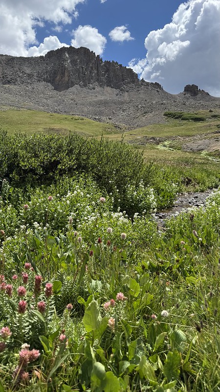
Canby Mountain on right
Canby Mountain on right - Colorado Trail segment 23
Headwaters of the Rio Grande
Headwaters of the Rio Grande - Colorado Trail segment 23
Rio Grande valley
Rio Grande valley - Colorado Trail segment 23

We followed down the side of the Rio Grande valley and continued along the foot of one of the serrated topped mountains and came out on Stony Pass Road. The trail follows the road almost up to Stony Pass, but there is a trailhead to the Weminuche Wilderness just before the top.

Nearing Stony Pass road
Nearing Stony Pass road - Colorado Trail segment 23
Stony Pass road
Stony Pass road - Colorado Trail segment 23
Entering Weminuche Wilderness
Entering Weminuche Wilderness - Start of Colorado Trail segment 24

The trail skirts the mountain south of the pass and climbs a ridge over to Deep Creek valley. Unfortunately a big thunderstorm arrived just before we got up the ridge. We found a tiny canyon and hunkered down with our raincoats and umbrellas for over 45 minutes while lightning struck the ridge above Cuba Gulch several times.

Trying to beat the storm over the saddle
Trying to beat the storm over the saddle - Colorado Trail segment 24

Finally the storm pushed on to the north enough that we could go the last tenth of a mile over to the valley to the south. We were relieved to get down and off the ridge, and eventually it stopped raining.

Deep Creek valley
Deep Creek valley - Colorado Trail segment 24

Far Out said there were campsites and water near a trail junction. We saw some other people camped there but they were coming from the south and had collected water from the other side of a ridge that we didn’t want to go over since the thunderstorm was still close. We found a sloped spot for the tent and set it up not a moment too soon because it started raining again.

Looking for water in Deep Creek valley
Looking for water in Deep Creek valley - Colorado Trail segment 24
Campsite in Deep Creek valley
Campsite in Deep Creek valley - Colorado Trail segment 24

We huddled in the tent and made a cold-soaked dinner with couscous and dehydrated vegetables. We watched an episode of Rizzoli and Isles while the couscous soaked, and then while we ate it. It rained for over an hour - luckily the show had subtitles because the rain was noisy. Finally it stopped a bit before 8:00 so we could brush our teeth and pee before going to bed.

13 miles over about nine hours. It was an interesting day because we were literally high on the scenery for most of the day, and then chilled and worried for the last few hours.


Colorado Trail day 29

July 23, 2026

I heard alarms going off in another tent at 4:45 and 5:00. We didn’t get up until about 5:30. It had rained from about 10 to 11 the night before, sometimes quite hard. The inside and the outside of the tent were both very wet, the inside from condensation. I kept wiping the tent off but more moisture kept condensing on it in the chilly morning.

We had some hot drinks and Amish pies from the little store at the Matterhorn Motel for breakfast. The pies were disappointing - maybe would have been better if we’d had a microwave.

We got on trail a little bit before 8:00, but then we had to stop and filter some more water because we didn’t filter much due to the moose last night.

The trail climbs a series of ridges, each higher than the last, for six miles.

Colorado Trail segment 22
Marmot watching the trail
Marmot watching the trail - Colorado Trail segment 22

We learned that our firefighter friend who has been checking our mail and looking in on our house was called out to a wildfire and will be away for at least a couple weeks. Fortunately some of our several great neighbors agreed to take over. (We could still see a cell tower for the first couple ridge climbs.)

Ptarmigan and young
Ptarmigan and young - Colorado Trail segment 22
View to Lake San Cristobal
View to Lake San Cristobal - Colorado Trail segment 22

After six miles we reached the highest point on the Colorado Trail, 13,271 feet.

The highest point on the Colorado Trail
The highest point on the Colorado Trail - Segment 22

After that we descended steeply to some old mining roads that are jeep roads now. We walked past a few small, old mines.

End of Colorado Trail segment 22

Then the trail leaves the road to cut over to Lost Trail Creek Valley. We stopped and had some lunch – Nutella with fruit and nuts wrapped in a tortilla. The trail goes up this valley and towards the upper end of the valley we saw three more moose from a long distance.

Heading towards Lost Trail Creek
Heading towards Lost Trail Creek - Colorado Trail segment 23
Tributary to Lost Trail creek
Tributary to Lost Trail creek - Colorado Trail segment 23

The mountains surrounding the Lost Trail Creek valley are rugged and impressive looking. There are a bunch of unusual rock formations near the saddle at the top of the valley.

Rock formations in Lost Trail creek valley
Rock formations in Lost Trail creek valley - Colorado Trail segment 23
Rock formations in Lost Trail creek valley
Rock formations in Lost Trail creek valley - Colorado Trail segment 23

The descent on the other side is more gradual, and new mountain ranges were visible.

Pole Creek valley
Pole Creek valley - Colorado Trail segment 23
Area above Cataract Lakes
Area above Cataract Lakes - Colorado Trail segment 23

We followed the trail down a ridge and got a view of the Cataract Lakes. As we got closer we noticed a couple moose on the east side of the biggest lake. It started raining and we put on rain gear.

Cataract Lakes
Cataract Lakes - Colorado Trail segment 23
Moose at Cataract Lakes
Moose at Cataract Lakes - Colorado Trail segment 23

We followed the trail further to the intersection of the trail to Cataract Lakes and turned down it. The rain stopped. We found a campsite on the west side of the biggest lake and set our tent out to dry. One of the guys we’d talked with the night before came over to say hi. He and another guy were camped at the north end of the lake.

We got the tent set up and went to the lake to filter some water but the rain started again so we only got enough to make dinner. We had arrived around 4:00 so we had plenty of time - we sat in the tent and looked at the guide book to plan tomorrow’s hike. After the rain stopped Julie made instant mashed potatoes with chicken and cheese. We had some San Juan Shortbread we’d bought in Lake City for dessert with hot cocoa.

Campsite at Cataract Lakes
Campsite at Cataract Lakes - Colorado Trail segment 23

We filtered more water and heard a coyote and saw that the moose across the lake were noticing it, too.

Campsite at Cataract Lakes
Campsite at Cataract Lakes - Colorado Trail segment 23

We went to bed a bit after 8:00 since neither of us had slept well the night before.

14 miles over about eight hours.


Colorado Trail day 28

July 22, 2026

We got up and had some leftover dinner and Lake City Bakery pastries for breakfast, then we showered and packed.

We left the motel around 9:00 so they could clean the room and went to the Hiker Center. One of the volunteers was making little donuts that were delicious. I managed to get another couple days of blog updated while we waited for the shuttle up to the trail. We talked with some of the other hikers, including a guy from Texas, “Lifer”, who is 75 years old.

Trail Hiker Center - note the clocks
Trail Hiker Center - note the clocks - Lake City, CO

A bit before 11:00 they arranged for a second driver because there was about eight of us hikers hoping to take the shuttle. We got to the trail a bit after 11:30.

Shuttle to Spring Creek Pass trailhead
Shuttle to Spring Creek Pass trailhead - Courtesy of the Trail Hiker Center

We ran into Brightside, who we hadn’t seen since Bailey, at the parking lot. We told her not to miss the bakery.

The trail follows a jeep road for a few miles. We saw a sheep herder’s wagon, then four sheep, then saw the shepherd with his horse and dogs a mile later.

Shepherd with horse and dogs
Shepherd with horse and dogs - Colorado Trail segment 22

We stopped and ate an upscale “pig in a blanket” from the Lake City Bakery for lunch.

Looking back on Colorado Trail segment 22
Looking back on Colorado Trail segment 22 - Snow Mesa from segment 21 in distance

The trail leaves the road and climbs over a very smooth ridge. We got to the top and saw a cell tower on a nearby hill - we had very good reception for a couple miles. We also got some great views of mountains, including Red Mountain and the distant Uncompahgre Peak.

Red Mountain with Uncompahgre Peak in distance
Red Mountain with Uncompahgre Peak in distance - Colorado Trail segment 22

We could also see back to where we had hiked down from Snow Mesa on Sunday.

Colorado Trail segment 22

After descending a bit the trail climbs and begins following a ridge. After a bit under nine miles we arrived at the last water source for another nine miles. Several people were already camped there, some out in the large meadow and others in amongst the (mostly dead) dead trees.

Popular camping area on Colorado Trail segment 22
Popular camping area on Colorado Trail segment 22 - Rito Hondo creek

We set up the tent and then joined a group sitting in a circle and talking for a while. Then we went back to our tent and ate a calzone from the bakery for dinner.

Camp at Rito Hondo creek
Camp at Rito Hondo creek - Colorado Trail segment 22

We went to filter some water and saw a moose in the brush. We decided to just fill our collection bag and do the filtering back at the tent - once we were in the brush there was no way to tell if the moose might be moving towards us.

Moose at Rito Hondo creek
Moose at Rito Hondo creek - Colorado Trail segment 22

We had a tasty piece of fudge for dessert, then set up our sleeping bags and went to bed somewhat early. We read books on our phones for a while before trying to sleep.

9 miles in about five hours.


Colorado Trail day 27

July 21, 2026

We had stayed up somewhat late and didn’t get up until 6:30. Julie walked to the Lake City Bakery again and brought us pastries for breakfast and some calzones to freeze for our next dinner on trail.

Breakfast pastries from Lake City Bakery

We showered and Julie checked the Hiker Center for hand sanitizer and checked that we could get a ride to the trail tomorrow. I added a couple days text and photos to the blog.

We ate lunch of leftover pizza. Then we walked to a path along Henson Creek that goes down to where it meets the Lake Fork of the Gunnison River.

Henson Creek confluence with Lake Fork of the Gunnison River
Henson Creek confluence with Lake Fork of the Gunnison River - Lake City, CO
Lake City Fire Rescue
Lake City Fire Rescue - Lake City, CO

We stopped at the craft fair but there wasn’t anything we were interested in. We went to the Kennedy Dry Goods store - one of the volunteers at the hiker dinner owns the store. We bought some San Juan Shortbread for the trail. Julie got a spare pika sticker from Michael Underwood Photography.

We stopped by the Hiker Center again and one of the volunteers suggested we try a mango smoothie from Cafe 98. They were right: it was a great treat, really fresh.

We walked to the Post Office to send a postcard and mail some of the souvenirs we’d purchased home. Then we visited the Lake City Bakery to get breakfast for the next day as well as a lunch and some desserts and breakfasts for the trail.

The town felt different because all the through hikers we knew had left in the morning and only a couple new ones had arrived. It seemed like maybe more of the tourists who might have canceled reservations had come to town.

Back at the motel I worked on the blog again and enjoyed a couple of the beers we’d bought the day before. We got New Belgium’s Honey Orange Tripel - really tasty, but I really felt the 10% alcohol content. Hopefully not too many errors in the blog!

For dinner we walked the block to the Packer Saloon and Cannibal Grill. It’s a bit “tourist trap” but the food is good. (Alfred Packer bio if you don’t know why it’s the Cannibal Grill.)

Dinner at the Packer Saloon and Cannibal Grill
Dinner at the Packer Saloon and Cannibal Grill - Lake City, CO

Back at the motel I continued to work on updating the blog while Julie studied the script for the musical Into the Woods.


Colorado Trail day 26

July 20, 2026

We slept until 6:30, unfortunately not as well as we hoped - maybe it was a bit too warm in our room. Julie walked down to the Lake City Bakery and came back with several delicious pastries and a couple savory pastries/pockets. We ate the sweet pastries and saved most of the savory ones for lunch.

We walked down to Hiker Center to check the hiker boxes. We found a couple of ziplock bags and a small deodorant. We also picked up our clean clothes - it felt like valet service! Then we walked to the north end of town to the grocery store to shop for supplies. We found most of what we needed.

Presbyterian Church
Presbyterian Church - Lake City, CO

We brought the groceries back to the motel and then visited the nearby Hiker Center again to back-flow our water filter with the Sawyer syringe they had - hopefully that will speed up the filter a bit. Then we borrowed their loaner bicycles to ride down to the south end of town. The bikes were not great but it was easier than walking. We found an “add boiling water” dinner at the sporting goods store, then got a bottle of wine and some beers from the liquor store.

After dropping those off at the motel we returned the bikes. Then we ate the pocket/calzones for lunch and relaxed in the room for a while. We got some bills paid and emails looked at. Our WiFi at home had stopped working so we asked our caretaker to check on the battery backup.

We walked a couple blocks to the main old town shopping area and went to the Michael Underwood photography gallery. He has captured a lot of amazing photos from the area. We bought some stickers and small souvenirs and, because Michael recognized us as through hikers, we each got small free stickers.

San Juan Soda Co.
San Juan Soda Co. - Lake City, CO
Sundae and milkshake at the San Juan Soda Co.
Sundae and milkshake at the San Juan Soda Co. - Lake City, CO

As we walked (and biked) around town we kept running into other hikers. It is interesting and fun to be in a small town where we don’t know anyone, yet constantly find people we recognize. Lake City also clearly has a lot of community organization. For example, there is a swampy pond at the north end of town that has a trail with benches and a picnic table that was clearly a volunteer effort.

We found that most of the rooms at our motel are filled with other hikers and we chatted with them. The rooms have folding chairs for their tiny patios and in the afternoon many of us were sitting outside. There were several rain showers in the afternoon and it was pleasantly cooling - the rooms don’t have air conditioning.

It turns out that many of the rooms with hikers had been reserved by others, but with the Elk Fire causing the town to be in level one evacuation, most reservations had been canceled. That is, we might have had to stay somewhere else, but the fire actually helped us. Similarly, many reviews of the Lake City Bakery mention long lines, but Julie never had to wait.

For dinner we walked to the north end of town to the Silver Slice pizzeria. It is a small operation but they make very good pizza!

Silver Slice Pizza
Silver Slice Pizza - Lake City, CO

After dinner we found canopy tents being set up in the old downtown area for a what looks like a craft fair, and there was live music at the Packer Saloon and Cannibal Grill so we wandered around a little.


Colorado Trail Day 25

July 19, 2026

Another chilly but fairly calm night. We got up around six. We only made one round of hot drinks and we managed to get on trail at 7:35 just as the sun finally made it over the ridge to shine on our campsite.

Dead forest in Mineral Creek valley
Dead forest in Mineral Creek valley - Colorado Trail segment 21

We hiked down to East Mineral Creek and filtered some very chilly water that looked a little yellow before filtering - a well-named creek. Then we hiked steeply up and over a ridge. From there we crossed a rock jumble below a cliff where we stopped for a snack in the shade. After that we began a three and a half mile climb of 1300 feet up to 12,700 feet.

Colorado Trail segment 21

The climb brought us over a ridge to completely different country - a high, rolling, plateau with huge views of distant mountain ranges. It was warm on the plateau. We stopped for lunch and Jim, a hiker we had been leapfrogging since the day before, walked by and mentioned that it suddenly felt like North Dakota but 7,000 feet higher.

Colorado Trail segment 21
Snow Mesa and chalky cliffs below
Snow Mesa and chalky cliffs below - Colorado Trail segment 21
Snow Mesa
Snow Mesa - Colorado Trail segment 21

After about five miles we arrived at a canyon that provided a way off the plateau. For two miles we dropped 1300 feet to Highway 149 where we waited for an hour and a half for a shuttle from the Lake City Presbyterian Church to pick us up.

Matterhorn Motel
Matterhorn Motel - Lake City, CO

We’d made reservations at the Matterhorn Motel and the friendly volunteer driver from the church dropped us off there. We unpacked a little, showered, and washed some underwear in the sink since everything was dirty, and then walk a block and a half to the church where they were hosting a hiker dinner.

For a dozen Sundays in the summer, the church provides a main course and church members bring potluck sides and desserts. Through hikers on the Colorado Trail or Continental Divide Trail are welcomed and cheered. It was an amazing feeling of generosity. They even have volunteers who will do laundry for hikers because there’s no laundromat in town. We sat with a couple of the hikers we’d met on trail, one we hadn’t met yet, and some of the church members and had some good conversations during dinner. One of the volunteers said she’d do our laundry, so we grabbed some laundry bags and walked back to the motel to fill them with dirty clothes, then returned them to her.

Catching up with Bear Squared
Catching up with Bear Squared - Lake City Trail Hiker Center Sunday dinner

After dinner we wandered around the town a little. There are lots of historic buildings and some nice shops.

12 miles over about seven hours.


Colorado Trail day 24

July 18, 2026

We woke up a little bit before 6:00 and the cows started talking to each other loudly a little bit after 6:00 so we got up then. It had been a pretty chilly night and we were both a little bit cold even with our puffy jackets on inside the bedding.

Cow using stump as a scratching post
Cow using stump as a scratching post - Colorado Trail segment 20

We used nearly the last of our water to make some hot drinks, leaving just enough to brush our teeth and have a few gulps to hike towards a new water source. We left camp at 8:00.

After about 3/4 of a mile, we passed a gate and the evidence of cows was reduced afterwards. In another mile or so we found a tiny creek flowing across the trail from the hillside. We went ahead and filtered a couple liters there. Even though it was very silty, we figured the cow patty content was very low.

Cochetopa Creek valley
Cochetopa Creek valley - Colorado Trail segment 20

After that, the going got a bit tougher. The slope increased, which matched the creek – where for the last 12 miles or so it flowed slowly and sinuously, now we often heard it rushing. This part of the canyon exhibited a little bit fresher erosion, with lots of large rocks to step over in the trail.

Towards the head of the valley, the trail crosses the main Cochetopa Creek. We stopped here to filter some water. A cute little bird that might have been a fox sparrow was taking a bath in the creek while we were filtering.

Cochetopa Creek valley
Cochetopa Creek valley - Colorado Trail segment 20
Cochetopa Creek valley
Cochetopa Creek valley - Colorado Trail segment 20

The trail got even steeper at the end of the valley and we climbed up to a saddle. Here we caught up with Greg and Highlighter. Highlighter had just come back down from climbing San Luis Peak, and Greg and we left our packs and headed up to the peak carrying just water and snacks. It’s about a mile and a half of steep climbing, 1500 feet. And it’s all on a big pile of rocks, a pile that gets surprisingly steep at the top.

Approaching San Luis Peak

It took us over an hour and a half to climb up, and we only spent less than 15 minutes at the top (14,022 feet elevation) because rain clouds were threatening. We got some Verizon service at the top.

Top of San Luis Peak
Top of San Luis Peak - Side trip from Colorado Trail segment 20

It only took about 45 minutes to climb back down. We were hungry as it was after 2:00 and we hadn’t had lunch, so we quickly made and ate some tortillas with salami and cheese, then we got off the saddle in case thunderstorms arrived.

Valley west of San Luis Peak
Valley west of San Luis Peak - Colorado Trail segment 20
Looking back at San Luis Peak
Looking back at San Luis Peak - Colorado Trail segment 20

The trail descended a ways into a big bowl / valley with some rocky spires around it, then it ascended a bit to go over a saddle to the next valley, a larger one. We descended to a little creek and had started to think about campsites so we filtered enough water to camp. As we worked on the last bottle of water the rain that had passed by before arrived. It rained pretty hard so we found a spot behind some bushes that was somewhat sheltered from the wind and hunkered down.

The rain went on for over half an hour. We ate some snacks and made some jokes. Eventually it lightened up enough that we decided to start hiking again. There was supposed to be a campsite sheltered by bushes about two miles away and it was now almost 5:00.

Looking back at San Luis Peak
Looking back at San Luis Peak - Colorado Trail segment 20
Two layers of rain protection
Two layers of rain protection - Colorado Trail segment 20

Working our way up over the next saddle warmed us up. We descended to San Luis Pass and looked for the campsite in vain. The next camping described in Far Out was a bit over two miles further, but up and over another big climb.

Clouds near San Luis Pass
Clouds near San Luis Pass - Colorado Trail segment 20

We decided to go for it since making that much progress meant we could make it to Lake City for the Sunday dinner after all. Greg had told us that in addition to the daily 12:00 shuttle to Lake City there was an additional 4:00 shuttle on Sundays. There was no way we could make it by noon, but 4:00 was doable.

San Luis Pass
San Luis Pass - Colorado Trail segment 21
Following Greg over a saddle
Following Greg over a saddle - Colorado Trail segment 21

The climb was the steepest of the day (not counting the side trip to the peak without packs) and the wind started blowing hard from the south where it was raining far down the valley. It was difficult and stressful but we made it over and there was far less wind on the other side.

Saddle to Mineral Creek
Saddle to Mineral Creek - Colorado Trail segment 21

The descent into the East Mineral Creek valley was steep, but we were glad to get lower quickly. We finally found a really pretty campsite, although it was somewhat surrounded by dead trees. We arrived at 7:00.

We got the tent set up and made a curry dinner from Farm to Summit that really hit the spot. We made cocoa for dessert. As we finished brushing our teeth a moose suddenly showed up and seemed surprised we were there.

Campsite in Mineral Creek
Campsite in Mineral Creek - Colorado Trail segment 21
Moose near our camp at Mineral Creek
Moose near our camp at Mineral Creek - Colorado Trail segment 21

12 miles on the trail plus a mile and a half side trip to the top of San Luis Peak, which involved in additional 1500 foot ascent, for a total of 15 miles and over 5000 feet ascent, over 11 hours.


Colorado Trail day 23

July 17, 2026

It was a very calm night and we slept pretty well. We got up a bit after 6:00 and felt like two rounds of hot drinks would go well with our protein bars. We got on trail at 8:45.

We walked a couple miles in the big open area and found a couple bars of Verizon service as we crested a hill. We stopped for a while to check emails and make some lodging reservations in Lake City.

We got a bar of Verizon service here
We got a bar of Verizon service here - Colorado Trail segment 19

It started getting hot as the thin early morning clouds dissipated and we were walking in sagebrush country. We were glad when the trail (still a cattle access road) turned up a valley and entered a large forest of aspen trees.

Clouds looking dramatic
Clouds looking dramatic - Colorado Trail segment 19

We climbed over a ridge and dropped down into the Cochetopa Creek valley. The trail follows this creek upstream for twenty miles or more. Where we entered the valley it was fairly wide with numerous beaver dams causing the creek to curve back and forth. Some very dark clouds were further up the valley. Unfortunately a major feature of this valley is cow dung - the smell is pervasive.

Descending towards Cochetopa Creek
Descending towards Cochetopa Creek - Colorado Trail segment 19
Cochetopa Creek
Cochetopa Creek - Colorado Trail segment 19

We walked a few miles up along the creek and stopped in a nice aspen grove for lunch. We got our tortillas wrapped around cheese and salami with mayonnaise and mustard and had just started eating them when it started raining. We put on rain gear and finished eating.

Shortly afterwards the trail crosses the creek. There was a bridge at one time but it apparently washed out quite a while ago. It didn’t look like there was any way across without wading so we took our shoes off and waded across in our camp shoes.

Rocks mark where trail crosses Cochetopa Creek
Rocks mark where trail crosses Cochetopa Creek - Colorado Trail segment 19
Crossing Cochetopa Creek
Crossing Cochetopa Creek - Colorado Trail segment 19

We caught up with a guy we’d talked to earlier in the day filtering water at the crossing. We stopped to filter as well and Greg, who we’d met above the Breckenridge ski area, caught up with us.

We continued on, now on the west side of the creek, and saw that the beavers have been taking trees from surprisingly far up the side of the valley. In about a mile we entered the La Garita Wilderness Area. Unfortunately the cows range on the Wilderness.

Beaver activity on Cochetopa Creek
Beaver activity on Cochetopa Creek - Colorado Trail segment 19
Beaver dam on Cochetopa Creek
Beaver dam on Cochetopa Creek - Colorado Trail segment 19

After about four more miles we arrived at the Eddiesville trailhead, which is the start of segment 20. We used the vault toilet there, then continued across the road to re-enter the La Garita Wilderness Area.

La Garita Wilderness information
La Garita Wilderness information - End of Colorado Trail segment 19

We’d read about a nice campsite about a mile and a half in from the road - unfortunately it was already occupied at 5:15. We walked another couple miles before finding a nice-looking campsite.

We set up the tent and were working on dinner when Greg caught up with us. We joked a bit about how noisy the cows were being and he mentioned that he plays the flute. He serenaded us a bit and maybe it was a coincidence that the cows got closer and noisier?

Campsite on Cochetopa Creek
Campsite on Cochetopa Creek - Colorado Trail segment 20

Greg moved on as the skies darkened and he was still looking for a site. As we finished “cooking” (waiting for the boiling water we’d added to the bag to do its job) our Three Bean Chile with cornbread it started raining. We moved into the tent to eat.

Not long afterwards one of the cows showed up and seemed very curious about our stove and other smells around the camp. I went out and shooed it away but they are a little intimidating.

Curious cow in our camp near Cochetopa Creek
Curious cow in our camp near Cochetopa Creek - Colorado Trail segment 20

We needed to filter some more water, but we went down to the Cochetopa Creek and it smelled strongly of cow poop, and we watched the cows crossing creek and peeing in the water. We just couldn’t bring ourselves to filter that water and decided to minimize use until the next water source.

15.3 miles in nine hours, mostly fairly easy walking.


Colorado Trail day 22

July 16, 2026

We woke up a little before 6:00. It was a bit warmer in this area, at lower elevation, so we did not need our puffy jackets to sleep. We got up just after 6:00 aiming for an early start. We managed to get on the trail at eight.

The trail follows a little-used road up Pine Creek. At our campsite Pine Creek was dry, but about 3/4 of a mile upstream the road crosses the creek and water was flowing through a culvert there. We stopped and filtered a couple more liters because our next water would be about 8 miles further.

The trail (road) began winding up some tributary canyons to get up on the side of the valley for a couple miles. Then the trail leaves the road and goes straight up a hill to get to a saddle. It is quite steep for a short while there.

Once over the saddle the trail joins a different little-used road. That road leads to a well-used forest road, but we turned off after less than a mile on another cattle access road.

Cow crossing road
Cow crossing road - Colorado Trail segment 18
Chipmunk
Chipmunk - Colorado Trail segment 18

In this area is Cochetopa Pass, which translates in the indigenous language to “pass of the bison”. Archeological evidence shows that bison (as well as native peoples and other species) used this pass and other trails in the area to move between different environments that are separated by tall mountain ranges.

Cattle access road
Cattle access road - Colorado Trail segment 18

The cattle access road goes over a saddle and follows Los Creek down a valley. A north-bound Continental Divide hiker had told us the day before that the water was trickling in Los Creek but there was a side road that leads to a stock tank with nice water. We had planned based on this and so passed up an access to part of Los Creek that had a gentle flow. Unfortunately we either misunderstood, or that young lady has a very different idea of how far out of the way they would walk to get water. After wandering around a bit we ended up digging a little hole in a marshy area where water was trickling and filtered a liter and a half of dirty-looking water to get us to the next source.

The trail follows a road away from Los Creek up to a saddle. We stopped before the saddle under the last shady tree near the trail for lunch. “Energizer Bunny” hiked up shortly afterwards and joined us to eat her lunch. She has done a few other fifty-ish mile through hikes that sounded intriguing, including one around Catalina Island. She left a few minutes before we did, but we hiked at about the same speed, so we followed her at a distance for the next few miles.

We felt a few drops of rain at the end of our lunch and the clouds would continue to threaten rain all afternoon. Once over the saddle the primitive road enters a large, relatively tree-less valley. We did a lot of walking on roads today!

“Energizer Bunny“ headed towards Dome Lake
“Energizer Bunny“ headed towards Dome Lake - Colorado Trail segment 18

That cattle access / fence line road comes to a county road that we walked for a couple miles before turning off to another cattle access road which is the start of segment 19. Near this turn-off we found our first “trail magic”.

A couple named Marj and Andy who had done the Colorado Trail last year were camping there in their self-built van and wanted to give back. We caught up with Energizer Bunny and Highlighter enjoying the magic. We ate ice cream sandwiches, drank Gatorade, had some fresh fruit, got my phone charged, and dumped all of the three-plus days of trash we were carrying. Plus, they had some Leuko tape to cover some blisters Julie had developed. They also had gallons of water so we refilled some bottles. It was a wonderful, relaxing, surprise and Marj and Andy seem like great people.

Trail magic from Andy and Marj (left fore)
Trail magic from Andy and Marj (left fore) - Highlighter (orange hat), Energizer Bunny (pink hat), and us (photo courtesy of Andy)
Colorado Trail segment 19

We continued on another primitive road and soon it started raining. We got our umbrellas out because it didn’t look like it would last long. Within a half mile or so the rain stopped. We arrived at Ant Creek where Julie had read about a nice campsite. We went a little off-trail to check and there were a couple nice campsites under a mix of aspen and pine trees.

We sat down to do some planning. We had hiked 14 miles already, it was 4:15, and the next campsite with water would be Cochetopa Creek in six miles. Or we could stay at Ant Creek where there is a trickle of water. Or we could filter water at Ant Creek and look for a dry campsite somewhere, although none of the campsites described sounded very appealing. We had arrived at camp around 7:00 for the past couple nights and it made for a slightly stressful evening so we decided to stay at Ant Creek.

Campsite at Ant Creek
Campsite at Ant Creek - Colorado Trail segment 19
Campsite at Ant Creek (hidden in trees)
Campsite at Ant Creek (hidden in trees) - Colorado Trail segment 19

I used the water to wash clothes and take a little sponge bath. We spent some time trying to plan out the next few days. If we could arrive in Lake City on a Sunday there is a through hiker buffet dinner at one of the churches there, and lots of hikers try to be there. We thought we’d have to push hard to make it so we decided to just plan to arrive on Monday instead.

We had an “add boiling water” dinner and went to bed early. We heard coyotes in the distance.

Sunset on day 22
Sunset on day 22 - Colorado Trail segment 19

14 fairly easy miles over nine hours with ice cream sandwiches.


Colorado Trail day 21

July 15, 2026

We woke up around 6:00 and got up at about 6:20. Most of the people in tents around us had already gotten up but were being pretty quiet. We made some hot drinks and ate some protein bars, then most everyone except a young lady whose trail name was Highlighter left by 7:30. We used the water in the lake to do some laundry and ended up getting on trail at 9 o’clock.

The half mile hike back up to the trail was pretty steep. We returned to similar trail as yesterday – following a ridge line up and down hills through Lodgepole pine forests. We did get a couple of nice views when we got out into some meadows, but the distant mountains were hazy.

Colorado Trail segment 17

Julie had been noticing that little chipmunks are able to adapt to all kinds of environments - we see them in forests and on talus slopes. They are speedy and acrobatic, and usually pretty shy. Maybe Julie’s trail name should be Chippy, and I can be Sippy because we call the bottles with straws that we have on our pack straps “sippy cups”.

Chipmunk on Colorado Trail segment 17

Water was still scarce on this part of the trail. At Razor Creek someone had buried a stick so that where a bit of water seeps out of the ground it trickles off the stick, making it easier to collect.

Collecting water at Razor Creek
Collecting water at Razor Creek - Colorado Trail segment 17

It got quite warm until we stopped for lunch at about 1 o’clock. As we finished up lunch, thunder clouds began approaching from the northeast, more or less following us. They continued threatening for quite a while, and eventually we got a few spits of rain. The clouds started to look dramatic so we put some rain gear on, but it never really rained enough that we actually needed it.

Eventually, we took some switchbacks down a hill to Lujan Pass. Here the trail is a forest road for a couple of miles leading down to Colorado Highway 114 while following Lujan Creek.

Colorado Trail segment 17

The trail follows the highway for a couple tenths of a mile, then resumes as a trail on the other side.

Lujan Pass
Lujan Pass - Colorado Trail segment 17
Colorado Highway 114
Colorado Highway 114 - End of Colorado Trail segment 17

It crosses Lujan Creek for the last time and we filtered water there. We caught up with Highlighter there, and after she left and we were still working on our water, the young man from Nashville who we’d met on our first day caught up with us accompanied by the young lady headed for nursing school who we’d spoken with at Hancock Lakes. We pushed on for another mile to find a campsite but I think they decided to camp there - they’d had a much longer day than we had.

We found a site along Pine Creek and set up the tent quickly because dark clouds had rolled in again and then had an Alpine Aire African peanut stew “add boiling water” dinner, our first time trying that brand - it was tasty but a little more watery than would have been ideal. The clouds just ended up making the sunset more interesting.

Campsite at Pine Creek
Campsite at Pine Creek - Colorado Trail segment 18
Campsite at Pine Creek
Campsite at Pine Creek - Colorado Trail segment 18

14.6 miles of Colorado Trail plus half a mile to climb out of Baldy Lake.


Colorado Trail day 20

July 14, 2026

We slept OK. There was a little wind and rain overnight but nothing like some previous nights. We got up a bit after 6:15 and made a couple rounds of hot drinks to go with a couple protein bars. We were slower than all the other campers in the meadow and left last, getting on trail at 8:30.

A rare view to distant peaks on Colorado Trail segment 16
View on Colorado Trail segment 16

The trail more or less follows a ridge to the west for several miles with various ups and downs. After 10 miles it climbs down to Tank Seven Creek where we were able to get some more water. Water is very scarce in this part of the trail. We stopped and had some lunch at a campsite there by the creek. The trail then follows Tank Seven creek uphill for several miles, through a long, winding meadow in a wide valley where we saw a couple different groups of cows. Eventually, the trail leaves the creek and climbs up to Sargents Mesa.

Cows on Sargents Mesa
Cows on Sargents Mesa - Colorado Trail segment 17
Sargents Mesa
Sargents Mesa - Colorado Trail segment 17

From there it continues more or less following a ridge, again going up and down. It wasn’t very hard walking, but it was a long day. It started getting hot in the middle of the day but then it got breezy and cloudy later. Although we followed ridges for much of the day the trail was mostly in the forest so we didn’t get many views. It was a bit boring so we finished the The Murderbot Diaries book 2 we had started the previous day and also finished the short book 3.

Colorado Trail segment 16
Colorado Trail segment 17

We turned off the main trail and hiked half a mile down a steep hill to Baldy Lake. It’s the only water for several miles and various sources said it had nice campsites. When we arrived around 6:45 it started raining and we found all the three groups we had camped with the previous night as well as a couple other groups already set up. A little tent city by the lake. We met “Highlighter” here.

We set the tent up quickly in a spot between some of the other campers so we would have a dry place to put things. Julie started some dinner and I went down to the lake to wash the dirt off my legs. This part of the trail has a lot of fine dust and I didn’t want to put my very brown legs into my long underwear overnight.

Campsite at Baldy Lake
Campsite at Baldy Lake - Colorado Trail segment 17

The rain lightened and was almost done by the time our dinner was ready so we could eat outside. We talked a bit more with Bear Squared and shared a cup of hot chocolate with him after dinner. As the sun went down a bunch of bats appeared to feed on the few mosquitoes that had been bugging us.

17 miles of progress on the trail with a half mile side trip to Baldy Lake, a bit over ten hours.