Colorado Trail day 38
August 01, 2026
Colorado Day - Colorado turned 150 years old!
Julie woke up early but read her book in bed while I slept until almost 6:30. A couple people hiked past the tent before we got up. It was windy off and on overnight but our tent was well sheltered. Someone woke up very early with the moon shining through the trees and casting shadows from the aspen on the tent.

We made hot drinks and ate some protein bars, then got on trail a bit before 8:30. The trail stays high above Junction Creek for miles, winding in and out of tributary canyons. At one ridge we could look back and barely make out where the trail crossed the big talus slope the day before.

Eventually the trail crosses a ridge and follows a different canyon on an old road bed, gradually working its way around some ridges back to the Junction Creek canyon. With it being Saturday there were a lot of mountain bikers on the trail and a few side trails.


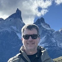
We found where we had five miles of trail remaining and took another “1%” photo.

There is a bench above a cliff called Gudy’s Rest in honor of Gudy Gaskill, the woman who instigated the Colorado Trail. We stopped there for a bit and talked to a woman with a couple of cute dogs.

The trail switchbacks down to Junction Creek and crosses it on a bridge. Then it follows the creek on the east side down to a couple of trailheads, one near the large Junction Creek campground, and finally the one where the Colorado Trail ends.

11.5 miles of trail over a bit under six hours. We made it!
We talked with an older couple in the parking lot who were waiting for their son to finish the trail. They said they would give us a ride, but they were going up to the Junction Creek campground so it would be the wrong direction. We walked down the road towards Durango with our thumbs out. There wasn’t much traffic but before we made it a mile a man and his daughter and two dogs picked us up. They were really nice and took us straight to our hotel even though it was out of their way.
We checked in to the Fairfield Inn & Suites a bit before the 3:00 check in time with a very friendly desk person. They have a laundry room so we were able to get most of our clothes clean while we showered.
Afterwards we walked across the Animas River to the downtown area and went to Steamworks Brewing Company. It was busy but we got a tasting flight while we waited for a table. The beers are better than many, the food was tasty, and we came back with a 4-pack of their Lizard Head amber ale.


We still have 11 miles to make up between Boss Lake and Monarch Pass, then we will have to come back next year to do the segments we missed due to the fire near Leadville, but it’s still quite a feeling of accomplishment. At the same time it is difficult to face “normal life“ again after living as full time hikers for over a month. I will try to write some summary thoughts soon.
Colorado Trail day 37
July 31, 2026
We woke up a bit after 6:00 and the sun rose around 6:15. We made hot drinks and tried Farm to Summit’s oat milk and granola for breakfast. We got on trail a bit before 8:30. A buck deer came near the camp, I think it was trying to eat the plants I had urinated on the night before. I saw similar behavior with a doe a couple days before - I guess some of the salt in the electrolyte mixes I drink must not be fully utilized.

Later that buck joined three others for a morning visit to the top of the nearby hill. I didn’t think the bucks spent time together, but this was like a morning meeting.

The granola was tasty but didn’t keep us full for long - after less than two miles we were looking for snacks. Granted, it was a tough couple of miles: we had to climb up and down a couple of very steep hills on the ridge we were following, Indian Trail Ridge.


Finally we climbed down near Taylor Lake. We stopped at a cute, tiny waterfall to filter some water. A short walk from the tiny creek coming out of the lake brought us to a trailhead parking area. We walked a bit further and stopped for another snack.

The trail climbed up to Kennebec Pass where there was a side trail that continued to an old mine with what looked like a somewhat modern house. I think it is the Muldoon mine.

The trail descended steeply across a huge talus slope. Snowmelt had eroded some parts - it was one of the scariest parts of the whole Colorado Trail. It’s also a south-facing slope with the sun shining, and the day was hotter than we have been used to for the past couple of weeks. We got down to some trees and stopped for lunch.

The trail continued dropping, generally not as steeply, down to Junction Creek. It follows the creek for a couple miles through a steep canyon with cliffs.

We stopped to filter some more water and wash some undergarments. With the heat we were going through our water faster than we grown used to. Eventually the trail crosses the creek on a bridge and then climbs up side of the canyon. Some of the climb was steep, and the footing and the slopes were tougher than the previous day - we started getting tired.
We had leapfrogged a cheerful young man a few times during the day. He told us August 1st is Colorado Day, and Colorado will be 150 years old when we finish the trail.
We found a nice campsite but realized we didn’t have enough water, so we ended up hiking another almost two miles to cross a creek and get more water, then found a little site near an aspen grove in a little saddle around 6:15.

15 miles over ten hours.
Colorado Trail day 36
July 30, 2026
There were some gusty winds overnight but otherwise fine weather. It felt nice to wake up to a completely dry tent. We got on trail a bit before 8:30.
Several people had passed by while we were setting up, eating dinner, and even some hiking with headlamps after we went to bed. However we passed only two tents in the morning - we (mostly me) are just slow in the morning compared to most through-hikers.
The trail follows down the Straight Creek Valley, crossing to the east side of the creek, then staying level along that side of the valley as the creek continues to fall. It crosses a small tributary stream and that is the last water source for almost 14 miles. Eventually, the trail leaves the valley and follows around the south side of a mountain. From there it follows along the top of a ridge, for several miles on an old road bed. A trail angel had left several gallons of water at a trailhead in this area but they were all empty.

The trail leaves the old road and begins skirting the eastern border of the Hermosa Creek Wilderness Area. The geology is interesting because the Hermosa Creek area seems to have eroded out of a different system of hills and valleys. For miles we walked with a steep drop to the left (west) and gently rolling country to the right. There is a forest road that also runs along the border of the Wilderness and some other trail angels left a couple other water caches where the trail meets the road. We took about half a gallon from one of these, although we ended up finally reaching Deer Creek still having about that amount - definitely better to have a little extra water than to run out - thank you anonymous trail angel! Although Deer Creek did not have a strong flow, it was flowing and we loaded up with a total of 5.5 liters.


We walked almost four more miles and found a really neat campsite tucked into some trees in a saddle, still having the big drop to the west.


The view to the northwest is fascinating to us because we can see distant mountains that we were on the other side of not that many days ago. Closer we can see Hermosa Peak and the ridge behind it - Cascade Creek and our thunderstorm night was behind that ridge. Further we can see the Needle Mountains - our descent down Elk Creek to the train was on the other side of those.

18.5 miles over almost 10 hours.
Colorado Trail day 35
July 29, 2026
It rained and sometimes poured from 10:15 to 11:15 with a light show and sound effects. Because we had chosen an established campsite there was bare dirt all around the tent. With how hard it rained that dirt quickly became mud puddles that started splashing mud onto and a little bit into the tent. I moved some things around to try to mitigate it. It was very unpleasant but the tent did its job - despite puddles all around, water never came up from the floor and I don’t think the roof leaked, but the splashing made it hard to tell.
When we got up a bit before 6:00 almost everything we had that was not in a watertight bag was wet or damp, and a lot of it was muddy or at least dirty. We rinsed a few things off in the creek. Our neighbors left around 7:00 and we got on trail a little bit before 8:00.
The Cascade Creek valley was very pretty both the evening before and in the morning, but the lighting and angles never made for great photos.

We crossed the creek and climbed up out of that valley and followed a ridge across a few more creeks. Eventually we climbed up to a saddle and entered the valley where Bolam Pass and Hermosa Park are, and our first glimpse of Lizardhead Peak.


We had driven up a jeep road a couple years ago and hiked a few miles of the Colorado Trail below Hermosa Peak. We hiked across the wide valley and up to the base of Hermosa Peak and had lunch in the same spot where we had talked to a Colorado Trail hiker on that trip. The previous day we had hiked up to the base of Lizardhead Peak and the views from there were very memorable.


We continued around Hermosa Peak and then around a couple of red rock peaks. We stopped at the top of the valley formed by Silver Creek and filtered water. There was a fairly nice campsite there and the clouds were looking threatening off and on. Eventually we decided to go ahead and climb over Blackhawk Pass to the Straight Creek valley.


We found a number of the campsites taken. The trail crosses Straight Creek twice and a tributary as it climbs out of the canyon, but that is the last listed water source for over twelve miles, so this canyon is a very popular camp area.


We eventually chose a somewhat sloped site that looked like it might have been used before. We set the tent up and left it empty so the wet interior could dry for well over an hour. It turned out there was a tiny brook nearby so I was able to do some laundry while Julie made dinner. This time we tried Butternut Dahl curry from Peak and it was pretty good.

We filtered more water to get a head start on tomorrow’s load and then set up our sleeping bags.
14.2 miles over nine and a half hours.